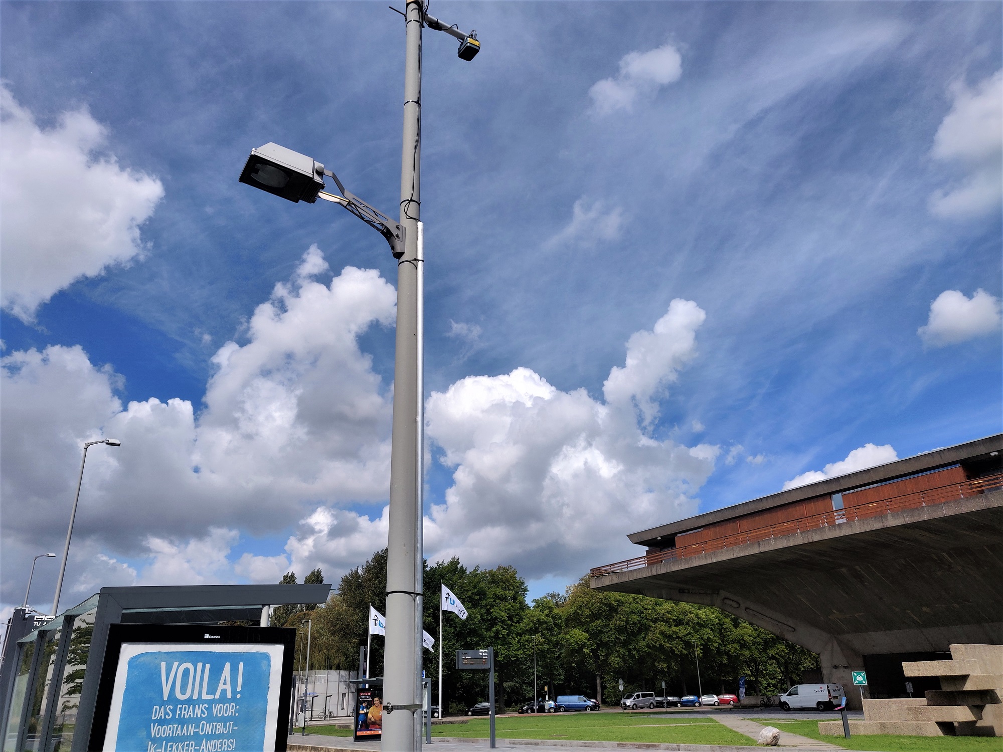
The TU Delft campus is becoming an open air lab for traffic flows. The plan has already been in the pipeline for a while, but corona has pushed it into the fast lane.
Delft scientists are investigating if pedestrians and cyclists can maintain enough distance from each other, using cameras. (Photo: Marjolein van der Veldt)
With cameras at eight strategic points, the security service is keeping an eye on the campus, and particularly the places where it gets busy. The cameras are causing a ruckus.
But the observant will have seen that many more cameras have been installed in the last few days, many of them on lamp posts. Take for instance the one the corner of the Jaffalaan and Mekelpark or at the bus stop in front of EEMCS.
‘These cameras don’t really film you’
“We’ll have about 30 of them on campus by the end of the week,” says traffic expert Prof. Serge Hoogendoorn of the Faculty of Civil Engineering and Geosciences. He prefers to talk about sensors rather than cameras “as these cameras don’t really film you. They register pedestrians and cyclists and reflect them as moving dots in a space rather than as recognisable individuals.”
The units contain processors that generate dots from the 3D video images. The researcher explains that the system is designed to make it impossible to see video images. “We have thought about privacy and security issues. We have ticked the boxes, believe me.”
‘The urgency to make sure that people maintain distance from each other is higher than ever’
Hoogendoorn and his colleagues in the Department of Transport & Planning are interested in traffic flows. “We want to look at mobility in terms of the integration of the systems. The plan for a traffic lab on campus has been around for a while. Corona has pushed it into the fast lane. The urgency to check that people are maintaining distance from each other and how we can avoid congestion is higher than ever.”
The project is being led by Serge Hoogendoorn and Dr Sascha Hoogendoorn-Lanser. “It’s rare to run a research project with your wife,” says Hoogendoorn. Hoogendoorn-Lanser works at TU Delft’s Valorisation Centre. She is looking into the possibility of extending the campus project.
The ultimate goal is to make a website that shows the traffic flows and the traffic congestion around the whole city of Delft. They call this site the digital twin – a digital copy of the city. In time, this digital twin may be used to recommend certain, quieter, routes to people, advise them to travel at a different time, or by another means of transport.
A better spread of students and staff to and from campus is one of the goals. “We are talking to the Rotterdam-The Hague Metropolitan Area and the municipality of Delft to see if we can monitor the bicycle and pedestrian connections between the Delft Campus and the TU Delft campus,” says Hoogendoorn-Lanser. “By making better use of the Delft Campus station to access TU Delft, we can reduce the congestion on the bicycle routes to and from Delft station.”
Apart from the data that the researchers are gathering with the cameras, they are using publicly available information from the municipality of Delft. This could be the opening times of bridges and the real time locations of public transport (trains, buses and trams).
The researchers hope that the research will also show if measures to improve the traffic flow, such as introducing one-way traffic and installing traffic lights that respond to the flow of cyclists and pedestrians, will have effect.
“And we also want to improve our models,” adds Hoogendoorn. “Our colleague Prof. Piet van Mieghem (Faculty of Electrical Engineering, Mathematics and Computer Science, eds.), is developing epidemiological models to better understand the spread of the coronavirus. We will be able to supply data to improve those models. How long people stand close to each other is, for example, interesting information.”
But a TU Delft site mentions a completely different (and somewhat dystopian) application. It states: “If we have data available on the positions of pedestrians or cyclists, we can use lasers to project a circle around a pedestrian, or make use of colour-changing street lighting.”
“This appeared in a white paper in which we freely speculated about what could be done in the far future,” explains Hoogendoorn-Lanser, “We have never considered using this application.”
Hoogendoorn says that “The measures that we are thinking about are comparable to the measures that have been used for car traffic for years, such as adapting traffic lights and recommending quiet routes. Do you know what’s funny? We are so used to having a little box in the car with GPS sending us all over the place. But as soon as it’s about cyclists and pedestrians, everyone gets very nervous.”
The TU Delft research team has a lot of experience with sensors. They placed them in the Wallen (the red light district, eds.) in Amsterdam to obtain information on pedestrians’ behaviour. And during the Sail 2015 yacht event they worked with similar cameras.
The research version of the website is almost finished. “Once the dashboard works well enough to have added value for students and staff, we will see if we can make a second version that is publicly accessible,” says Hoogendoorn-Lanser.
Most of the cameras are due to have been placed by the end of next week. An explanatory sticker, a telephone number and the address of a website explaining the project will be stuck near each sensor.
Could TU Delft’s security staff also have used these types of sensors to monitor gatherings. “In principle it is possible,” says Hoogendoorn. “You see dots instead of recognisable individuals. The security staff would have to get used to this aspect.”
Do you have a question or comment about this article?
tomas.vandijk@tudelft.nl


Comments are closed.